The third-largest city in the U.S. is not only a major Midwest transportation hub, but it’s also home to one of the biggest and best public transportation networks in the world. The Chicago Transit Authority’s “L” train system and extensive bus routes can get you just about anywhere you need to go in Chicagoland. Operating 24/7, the CTA averages 1.6 million rides a day, but trains and buses aren’t the only way to get around town. Read on for your complete guide to Chicago transportation, plus a breakdown of the top Chicago neighborhoods and what it’s like to commute from them.
The “L”
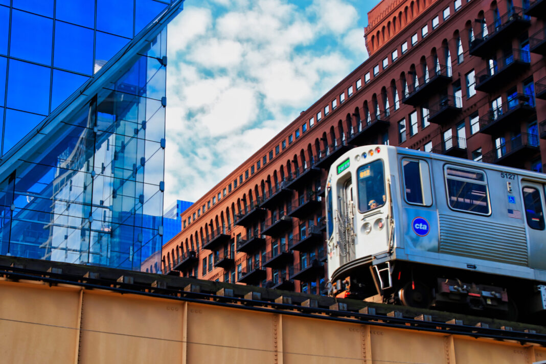
The CTA operates eight “L” train lines and 145 rail stations all over town and in the surrounding suburbs of Evanston, Skokie, Wilmette, Rosemont, Forest Park, Oak Park, and Cicero. It’s called the “L” because most of the track is elevated above the city, but some parts of the system are at street level or underground. The city’s eight rapid transit lines are laid out in a spoke style, which centers all lines around the Loop.
Rail lines are distinguished by color: Red, Blue, Brown, Green, Orange, Purple, Pink, and Yellow. The Orange, Purple, and the Pink Lines circle the Loop clockwise, while the Brown Line runs counter-clockwise before returning to their starting points. The Green Line is the Loop’s only through service. All lines run daily except the Purple Line Express to downtown, which doesn’t run on the weekends. Both the Red Line, with service between the North and South Sides via downtown, and the Blue Line, which connects Chicago O’Hare International Airport and downtown, run 24/7. You can check train frequencies on the CTA Train Tracker, but most routes run every 10-20 minutes through late evening.
A standard ride costs $2.50, while day passes run $10 and monthly passes run $105 and can be purchased through the fare payment system, Ventra. Buy individual tickets, passes, or transit value online, by smartphone, via contactless bank card, or at participating retail locations. Ventra can also be used on CTA buses, Pace (suburban buses), and Metra (commuter rail).
Bus
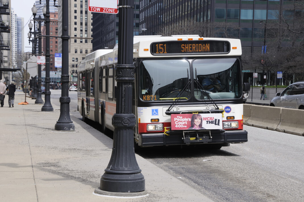
The CTA operates about 2,000 buses with over 150 routes that serve a million passengers a day. Over 12,000 bus stops are conveniently located throughout the city, with announced stops every couple blocks, but you can pull the stop request cord to get off at any designated stop. Most buses run up and down the same street all day, every day—few routes branch out. Most routes run every 10-20 minutes through late evening. Get estimated arrivals with the CTA Bus Tracker. Be sure to check the destination sign, as not all buses travel to the end of the line. Night Owl lines run until 2am or later with service every 30 minutes. All buses are accessible and have bike racks. On the bus, you can pay $2.50 cash for a single trip or use Ventra and save $0.25.
Greyhound
Greyhound can get you to other cities by bus. Its options include routes to Indianapolis, Cincinnati, Louisville, Nashville, Atlanta, Cleveland, Pittsburgh, Washington, New York, Detroit, Toronto, Milwaukee, Green Bay, Madison, Minneapolis, St. Louis, and Memphis.
Pace
Get to and from the ‘burbs with Pace, the region’s bus system that connects suburban towns in the Chicago area to the city center. Major routes run daily through mid-evening, every 30 to 60 minutes. Many routes connect with CTA. Pace also uses the Ventra fare payment system, or you can use your own contactless bank card to ride.
Metra Commuter Trains
With 11 lines operating out of 242 stations, Metra, the city’s commuter rail system, serves Chicago and the surrounding areas of Blue Island, South Chicago, Aurora, Joliet, Fox Lake, Elgin, Antioch, Orland Park, Waukegan, and Elburn. With four downtown terminals: Richard B. Ogilvie Transportation Center, LaSalle Street Station, Millennium Station (fka Randolph Street Terminal), and Union Station, this high-speed system is a fast and easy way to get to the heart of the city. Most routes run daily every hour or two with more frequent service during rush hour. Fare is based on zones instead of a flat boarding fee like on the “L”. Monthly Metra ticket holders can get a Link-Up Pass to use on CTA and Pace. Bicycles are allowed on board, just not during rush hour or special events.
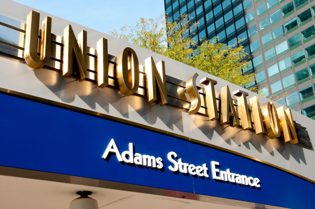
Union Station
Known for its majestic Great Hall, Union Station offers connections to Metra and the “L”. Owned and operated by Amtrak, Union Station is the fourth largest intercity passenger hub in the U.S., offering several transcontinental routes. Anyone going through Chicago must transfer trains—unlike most Amtrak stations, all Union Station trains either originate or terminate there.
Getting Around by Car
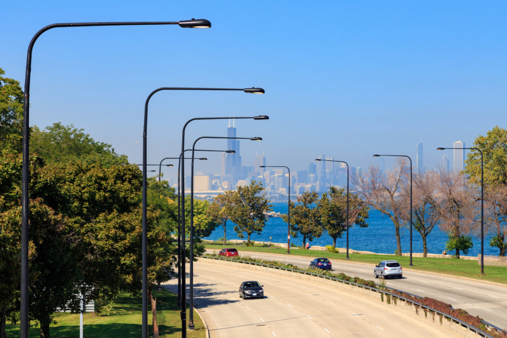
Getting around the city is easy without a car, which is why many Chicagoans don’t own one. The ones who do spend a lot of time looking for parking. The Chicago Parking Map offers an interactive map of public parking facilities downtown, while iParkit lets you reserve a spot. More apps that can help drivers find parking include Millennium Garages, ABM Parking, ParkChicago, and SpotHero. However, remember it’s illegal to use your phone while driving in Illinois.
Taxis
Chicago is home to around 7,000 cabs, so hailing one isn’t hard in most neighborhoods. Don’t just keep an eye out for yellow cabs—taxis can be any color. Fares rack up quickly, so cabbing around the city can get pretty pricey. It’s $3.25 just to get in the cab, a flat fee of $1.00 for the first additional passenger, another $.50 for each additional passenger between the ages of 12 and 65, .20 cents for each additional 1/9 of a mile, another .20 cents for every 36 seconds of “wait time” when stuck in traffic, another four bucks in taxes from the airport, and an extra .50 cents if you’re using a credit card. E-hail and e-pay with ARRO and CURB. Lyft and Uber also operate here, which is the more popular form of “taxi” service.
Walking

Chicago is on a flat plane, so it’s easy to walk or bike around. It’s also easy to navigate since the streets are on a grid starting at the intersection of State and Madison streets downtown. Madison Street divides North from South, while State Street divides east from west. When it gets cold walking around The Windy City, (and it will) downtown’s downtown’s Pedway is your best friend. The underground tunnel and bridge system links together 40 blocks of the Central Business District to keep commuters warm in winter months. If you get tired of hoofing it, many locations and events with high pedestrian traffic draw pedicabs that you can hire to take you the rest of the way.
Biking
With 290 miles of protected bikeways, Chicago was made for cycling. Divvy, the city’s bicycle-sharing system operates 5,800 bikes out of 580 self-service docking stations in Chicago, Evanston, and Oak Park. Bicycles are permitted on CTA buses’ front-mounted bike racks and on trains, except during rush hour or special events.
Getting to and from Chicago Airports
One of the busiest airports in the world, the sprawling O’Hare International Airport serves as a hub for United Airlines and American Airlines. Located on the south side of Chicago, Midway Airport is convenient for domestic travel. The L’s Blue Line can take passengers from the downtown area to O’Hare in 40 minutes, while the Orange Line is the most convenient way from the Loop (the city’s central business district) to Midway, with a travel time of about 25 minutes.
Commuting in Chicago’s Top Neighborhoods
Chicago is widely known as a city of neighborhoods. Here are some transportation pros and cons for some of the city’s best neighborhoods.
Lakeview: There’s always something happening here, but if you want to leave the neighborhood, there are 6 L stations and plenty of CTA bus routes (many of which offer all-night routes/overnight service) to connect you with the rest of the city. Those running along North Lake Shore Drive with express services to downtown Chicago see the most action. Head down Lakeshore Drive to arrive downtown in about 20 minutes by car.
Lincoln Park: Transportation from this neighborhood is easy, so commuting to work will be a breeze. Multiple train and bus lines serve Lincoln Park, which is also extremely walkable. Hop on the “L” and take the Red, Brown, or Purple line from the Fullerton station into Downtown. Lincoln Park can be reached by car via the Kennedy Expressway or Lake Shore Drive, which can have you downtown in 15 minutes.
West Loop: Most people will be coming to you. The Loop is technically within walking distance, but the Green Line is a quicker option and can get you easily around the city.
Logan Square, Bucktown, and Wicker Park: This area is served by the North Avenue bus line and multiple Blue Line stops, including one at the intersection of North, Damen, and Milwaukee Avenues. Known as Six Corners, this is a good place to start exploring. The Blue Line’s Western stop connects to downtown, the suburbs, and O’Hare, while Bucktown’s bus routes connect the neighborhood to Lincoln Park, Old Town, and the lakefront, not to mention the Red, Purple, and Brown Lines. Metra has a stop at Clybourn Avenue that connects to downtown and the northern suburbs. If you’re driving, shoot down the Kennedy Expressway/I-90/94 into Downtown. It’s only a handful of miles away, but it’ll take you a good 20 minutes in traffic.
River North: This classic Chicago neighborhood is in the center of the action, so it’s a great place to live for those who hate commuting. The Red Line stops at Grand subway station on N State Street, shuffling passengers through downtown between the North and South sides of the city. Get to the Loop in 15 minutes or less via the Brown or Purple Line, which both stop at Chicago Avenue and Merchandise Mart.
Edgewater/Andersonville: Get away from it all but still be just a train ride away. Take the Red line all the way downtown or take the bus (50) to Lincoln Square and hop on the Brown line and head straight to the Loop.
Ukrainian Village/Humboldt Park: Neither are close to the “L,” so be sure to familiarize yourself with the multiple bus lines that run through Ukrainian Village if you don’t have a car.
Transportation in Chicago is abundant and efficient. Find your next home on Zumper and become a local with this transportation guide.
Related content


